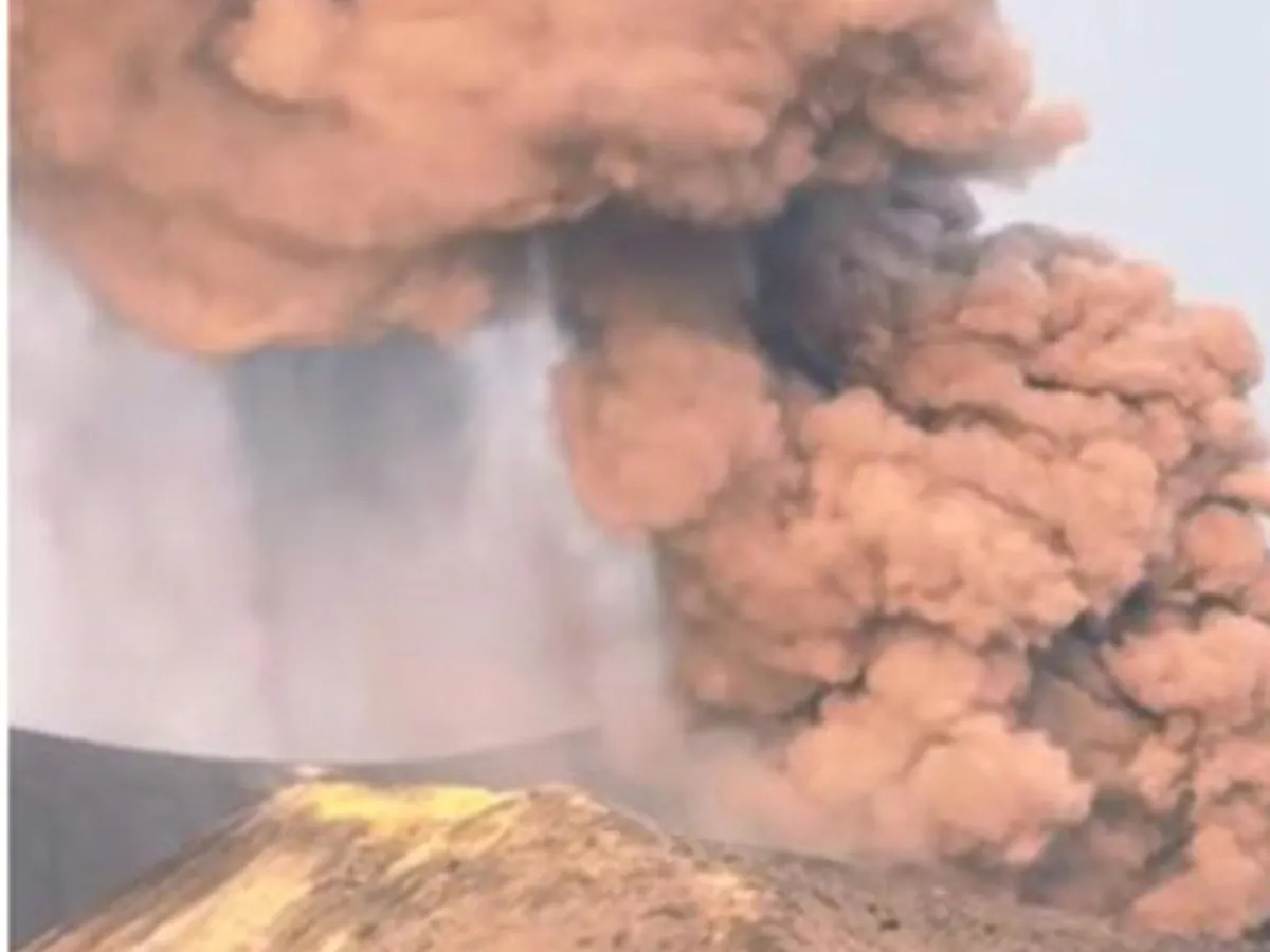
Indonesia's Geological Agency (Badan Geologi) raised Anak Krakatau to Level III (Siaga, or Alert) on July 2, 2026, at 4:30 p.m. local time, roughly two and a half hours after the volcano in the middle of the Sunda Strait erupted and sent a gray-to-black ash column about 200 meters above the crater. Civilians, fishers, tourists, and climbers are barred from within 3 kilometers of the activity center.
1,547 seismic events in 16 days
The upgrade was grounded in documented escalation. Between June 16 and July 2, 2026, monitoring equipment recorded 740 volcanic emission quakes, 520 hybrid or multi-phase quakes, 247 low-frequency quakes, 24 harmonic tremors, and 16 continuous tremors: 1,547 seismic events in 16 days. Low-frequency quakes and continuous tremors in that list point to fluid or magma moving inside the volcano's body.
The eruption at 2:05 p.m. local time was the culmination of that escalation. The ash column tilted northwest; seismographs recorded a maximum amplitude of 23 millimeters over a 20-second duration. Lana Saria, Acting Head of the Geological Agency, explained what the signals meant: "The increase in earthquakes associated with shallow volcanic earthquakes indicates magma dynamics at the surface of Anak Krakatau."
The agency then issued its formal statement: "Based on thorough analysis and evaluation, the activity level of Anak Krakatau Volcano is raised from Level II (Waspada) to Level III (Siaga), effective July 2, 2026, at 4:30 p.m. WIB." Cited threats include pyroclastic flows, lava flows, volcanic projectiles, and heavy ash rain if the eruption intensifies.
Is there a tsunami risk like 2018?
According to the Geological Agency, there is no tsunami indication from this alert. Level III (Siaga) is a volcanic alertness upgrade. Coastal residents of Banten and Lampung were asked to remain calm, not to believe rumored tsunami threats, and to follow official updates from the Geological Agency and local disaster management agencies (BPBD).
Public concern about tsunamis is understandable. On December 22, 2018, at around 9:27 p.m. local time, roughly 64 hectares of Anak Krakatau's southwest slope collapsed into the sea. The resulting wave reached the Banten and Lampung coasts within minutes; the National Disaster Management Agency (BNPB) recorded at least 437 deaths across five districts: Serang, Pandeglang, Lampung Selatan, Pesawaran, and Tanggamus. The disaster struck at night, during the busy year-end holiday season, without adequate warning.
The 2018 tsunami originated from a sudden flank collapse. Indonesia's early warning system at the time was designed primarily to detect tsunamis from tectonic earthquakes, so the volcanic flank collapse was not read in time. Current monitoring shows gradual magma movement near the surface, not signs of acute slope destabilization. That is why the Geological Agency, in the same announcement as the level upgrade, specifically asked coastal residents not to believe tsunami rumors: two different mechanisms call for two different responses.
Distinguishing quickly between those two hazard categories is its own risk-communication challenge, as seen when a magnitude 7.7 quake triggered a Sangihe tsunami warning that was lifted three and a half hours later after authorities verified actual conditions.
Sunda Strait in the holiday season
Anak Krakatau grew from the caldera of the 1883 Krakatau eruption and is one of Indonesia's most active volcanoes. Its position in the middle of the Sunda Strait puts it directly adjacent to the Merak-Bakauheni ferry crossing, densely populated coastal communities in Banten and Lampung, and tourist areas currently busy during the school holiday break.
The 2018 collapse permanently changed the volcano's morphology: the peak height dropped sharply and part of the southwest flank disappeared into the sea. Since then, Anak Krakatau has become one of the most studied cases in global volcanic tsunami research, a threat that is harder to warn about in advance because it is not always preceded by a large, widely detectable earthquake. The 2018 Palu earthquake on the Sausu Fault is another reminder that past disaster trauma shapes public perception well beyond any official danger radius.
Andi Suwardi, Head of the Anak Krakatau Monitoring Post, urged residents to comply with the Geological Agency's recommendations and to avoid any activity within the exclusion zone. The readiness of the post-2018 coastal warning system has not been made public: how many monitoring devices and sirens are now operational at vulnerable points in Banten and Lampung, and how quickly evacuation protocols could be executed for a flank-collapse scenario. Seismicity trends and the volcano's deformation over the coming weeks will determine whether Level III can be downgraded or needs to go higher.